
Louisville Neighbors by Source
No public source supplies a complete roster of a Louisville block. LOJIC draws the parcel setting, PVA names assessed owners, deeds explain recorded interests, and civic pages identify neighborhood groups. Voter information has a narrow legal route. Each source has its own date and meaning, so owners, registered voters, association contacts, and historic occupants must remain separate.
| Source | Block Detail | Access Route |
|---|---|---|
| LOJIC Online | Parcel shapes, addresses, adjacent parcels, reports, buffer and measure tools | Public viewer; lines are not legal boundaries |
| PVA Address Search | Owner, parcel, assessed value, acreage, neighborhood, and update date | Free address/parcel search; expanded tabs require subscription |
| Jefferson deed index | Recorded ownership and party history | August 1984 forward; archive 1966 to 1984; older office route |
| Metro public notices | First-tier and second-tier planning-notice parcels | LOJIC parcel workflow and notice materials |
| SBE voter file | Lawful voter-list fields in street order | Qualified SBE-84 requesters and purposes only |
| District civic pages | Association names and neighborhood profiles | Public pages, without full member rosters |
| LFPL directories | Historical occupants by address and year | Library, database, or archive access |
An owner record proves the tax roll identifies a named party with a parcel. It does not prove that the owner lives there or list everyone inside. A directory is a dated publication snapshot. Voter data covers registered voters under access limits, not all residents. Those distinctions keep a neighbor search accurate.
Map Louisville Neighbors Parcel by Parcel
LOJIC Online accepts an address, street, or intersection. Turn on Streets, Addresses, Properties, and Labels, then click the target polygon. A parcel is a mapped unit of land. Select a Parcel Report, Land Development Report, or General Information Report to connect the map to PVA and development details.
- Verify the target address in both LOJIC and the PVA Address Search.
- Save the parcel ID and report identifiers before moving outward.
- Click each adjoining polygon and each parcel across the street. Record its address and parcel ID.
- Use Buffer for a defined radius and Measure for distance, then note the map date.
- Check every nearby address or parcel separately in PVA and preserve its owner, value, and update date.
LOJIC's Buffer tool defines an area; it does not create a resident list. Parcel lines also serve as orientation, not legal boundaries. A deed, plat, and legal description control title or boundary questions. For research along an entire road, move to the Louisville street directory workflow instead of expanding a block search without limit.
Louisville's Two Notice Tiers
Louisville Metro planning guidance offers a precise way to define nearby property. First-tier properties adjoin the subject parcel or sit across the street. Second-tier properties adjoin or lie across from a first-tier parcel and fall within 500 feet. This is a defensible planning-notice geography, not a list of everyone living near the project.
Search the subject address in LOJIC, open the parcel report and Owner Information, then mark the first and second tiers on the map. Multi-unit sites may need a Land Development Report and separate unit or parcel IDs. Preserve the parcel ID, situs address, map date, tier, and owner role. Do not merge those owners with voters or association members and label the result “neighbors.”
Insider tip. Use the official notice tiers when a fixed block radius matters; state exactly that the set represents parcels, not households.
Check Louisville Owners Carefully
The Jefferson County PVA Property Search supports an exact address, street-only browse, address range, or parcel ID. Punctuation, city, state, and ZIP are unnecessary in the address field. The free Basic Search can return ownership and assessed value. Subscription access adds transfer history, photos, improvements, property class, and tax information, and that expanded search is available at the PVA office or an LFPL branch.
Keep the situs and mailing addresses distinct. The situs locates the parcel; the mailing field directs assessment correspondence and can point elsewhere. A homestead exemption may support owner occupancy only when the actual card displays it. The inspected sample did not show that field. Never fill a gap by assuming that owner and occupant are the same person.
Louisville Neighbors and Voter Limits
Kentucky's public Voter Information Center is a self-check, not a block browser. It asks for legal first name, last name, date of birth, and an optional last four digits of the Social Security number. It cannot be used to browse everyone on a Louisville street.
A lawful SBE-84 request can provide qualified requesters with county, precinct, or district data in street or household-by-street order. Kentucky rules identify fields such as name, address, age code, party, gender, ZIP, and five-year participation history. They do not expose full birth dates, Social Security numbers, email, or ballot choices as ordinary list fields. Delivery can take seven to ten business days. The request carries a stated-purpose oath and restrictions on commercial use, sale, or transfer.
A street-ordered voter file still misses children, unregistered adults, protected voters, and some people in multi-unit addresses. An address error or old registration date may also make someone look nearby when they are not. Date every result and preserve the legal basis for access.
Louisville Neighborhood Association Layer
Metro Council district pages name civic groups, but they do not publish a complete citywide member directory. District 4 includes associations connected with Butchertown, California, Clifton Heights, Downtown Residents, Phoenix Hill, Russell, Smoketown, SoBro, and Victory Park. District 8 lists groups and area profiles for Belknap, Bon Air, Cherokee Triangle, Deer Park, Highlands-Douglass, Original Highlands, Tyler Park, and other neighborhoods. District 15 identifies Cloverleaf, Hazelwood, Iroquois, Schnitzelburg, Taylor Berry, Wilder Park, and more.
| Official civic source | Useful role |
|---|---|
| Metro Council District 4 | Association and business-group names for central neighborhoods |
| Metro Council District 8 | Neighborhood and home-rule-city profiles |
| Metro Council District 15 | South Louisville association inventory, including places with no current association noted |
| LOJIC city-neighborhood map | Named boundary reference dated August 15, 2026 |
An association can explain a boundary, meeting route, or civic issue. It cannot be treated as a roster of nearby households. The same limit applies to congregations, block watches, clubs, and private groups. Official sources inspected for Louisville did not expose public membership lists.
Neighborhood names also differ from postal cities and legal boundaries. Louisville's consolidated Metro, separate home-rule cities, urban neighborhood labels, USPS last lines, and Jefferson County parcels overlap in ways that can make one address appear under several geographic terms. Confirm the address on the LOJIC parcel map and PVA card before choosing a district group. The city-neighborhood map provides a useful label, but it does not establish association membership or legal jurisdiction.
Louisville Block Deeds Need Context
When an adjacent parcel needs ownership history, search the assessed owner in the Clerk's party-name deed index. Confirm the parcel through its legal description, book/page, control number, and dates. Trusts, estates, companies, liens, releases, mortgages, and easements may place names in the index without showing a household or a sale.
The Jefferson County Deed Room provides the office fallback for older books, plats, deeds, liens, wills, and name changes.
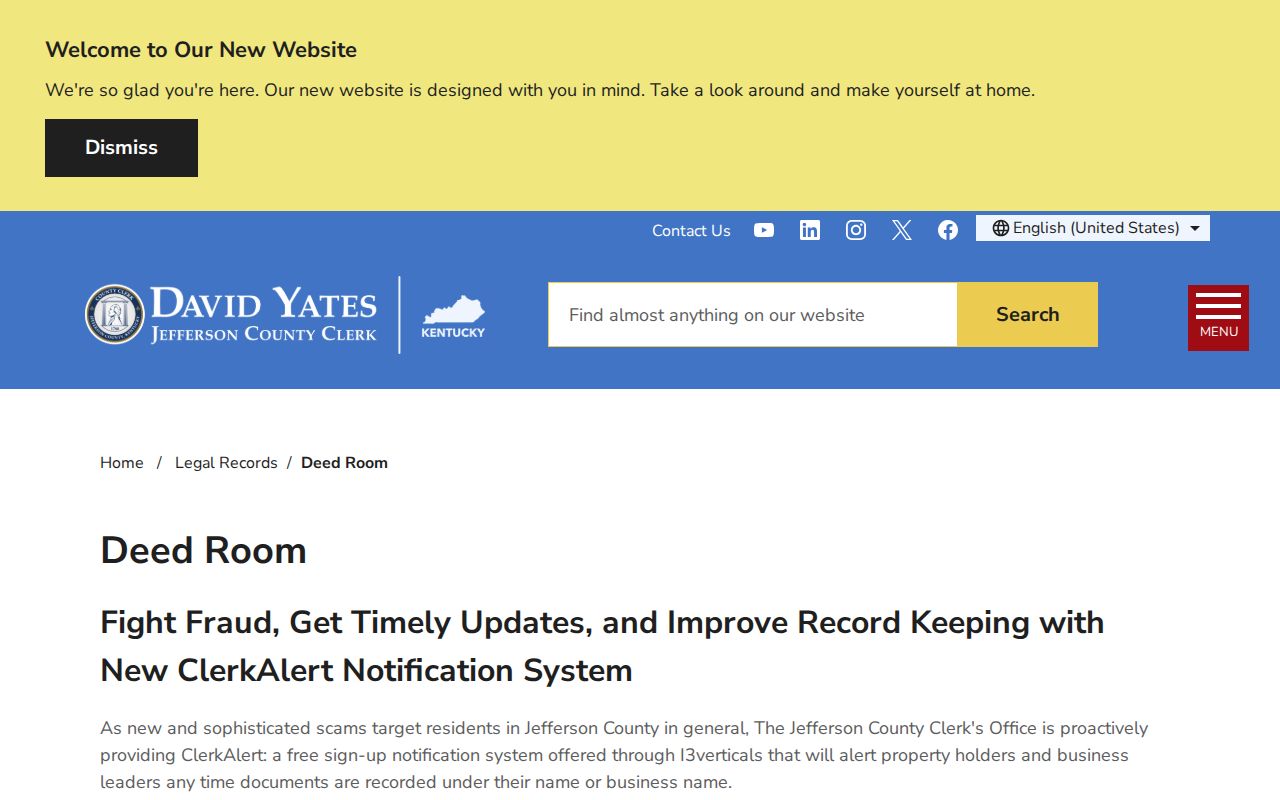
The page is useful when a web index stops, but recorded parties still must not be presented as all people living on the block.
Official Louisville Records Versus Profiles
Commercial neighbor tools may combine old addresses, phone data, or public-record copies into one profile. That convenience can hide age, source, and record role. Official records are narrower, yet each has a named custodian and a meaning that can be checked.
| Question | Official record route | Commercial profile category |
|---|---|---|
| Which parcel is next door? | LOJIC map and parcel report | May use an unclear boundary or radius |
| Who is assessed as owner? | Dated PVA card | May repeat an old owner without an update date |
| What transfer occurred? | Clerk index and deed image | May merge liens, mortgages, and conveyances |
| Which civic group serves the area? | Metro district page and group contact | May imply membership that no source proves |
Use a commercial result only as a clue if one appears elsewhere. Confirm the parcel, person, date, and record role with the custodian before relying on it.
Keep a source log with the query, access date, result date, and exact role shown. A map owner, deed grantor, permit applicant, voter, and directory occupant can all be different people. Recording those roles prevents an appealing but false composite profile of the block.
Protect Louisville Neighbors' Privacy
Public block records omit much by design. Property rolls do not list every resident. Voter files exclude people outside the registration system and restrict access and use. Utility, delivery, customer, and private-association lists are not ordinary public resident records. Court and vital records may be sealed or controlled.
Kentucky Safe at Home gives eligible survivors a substitute address, mail forwarding, and protected voter-address treatment. Certification lasts four years. A participant's real-estate holdings are not automatically hidden, but the physical address is not ordinary open-record material. Never try to reverse a substitute address or interpret an absent record as a negative identity finding.
Lawful use. Look up Louisville neighbors for civic awareness, reconnection, or personal safety. Never use block records to watch, threaten, expose, or harass anyone.