
Louisville ZIP Directory Coverage
The official LOJIC map groups ZIP areas with post-office labels across Louisville and Jefferson County. USPS last lines add another layer. The table keeps related codes together because official sources do not publish a reliable one-neighborhood-per-ZIP list. Neighborhood names are useful map clues, not postal or legal borders. Verify each parcel separately.
| ZIP Code | Areas Covered | Post Office | Notes |
|---|---|---|---|
| 40201, 40202, 40204, 40208, 40270 | Main and Downtown context | Downtown / Main labels | 40270 is an alternate group member, not parcel proof |
| 40203, 40210 | California, West Louisville and Russell context | Louisville 40203 last line | Neighborhood edges vary |
| 40205, 40213, 40221, 40255, 40261 | Highlands, Bowman, Belknap, Camp Taylor and Audubon context | Louisville 40205 group | Exact use of alternate codes was not located |
| 40206, 40207, 40257, 40280 | Crescent Hill, Clifton, Irish Hill, St. Matthews and Cherokee context | Louisville 40207 group | Postal and city lines may differ |
| 40209, 40214, 40215 | Fairgrounds, Iroquois, Beechmont and South Louisville context | Louisville 40214 group | Check the parcel |
| 40211, 40212, 40251 | California, Portland, Russell and West Louisville context | Louisville 40211 group | 40251 is a group member |
| 40216, 40256 | Shively and West Louisville context | Louisville 40216 group | May cover a neighboring municipality |
| 40217, 40269, 40299 | Shelby Park, Germantown and urban southeast context | Louisville 40299 group | 40269 is a group member |
| 40218, 40220, 40250 | Buechel, Hikes Point and Audubon context | Louisville 40220 group | 40250 is a group member |
| 40219, 40229, 40259 | Okolona, Highview and Southland context | Louisville 40219 group | Group members vary by address |
| 40222, 40241, 40242, 40252 | Lyndon, Brownsboro, Prospect and Hikes Point context | Louisville 40222 group | Check city status parcel by parcel |
| 40223, 40243, 40245, 40253 | Lyndon, Middletown, Anchorage and Prospect context | Louisville 40223 group | Home-rule cities share postal labels |
| 40228, 40291 | Fern Creek, Highview and Fairdale context | Louisville 40291 group | Exact boundary varies |
| 40258, 40268, 40272 | Pleasure Ridge Park, Valley Station and southwest context | Louisville 40258 group | 40268 is a group member |
| 40023, 40025, 40041, 40047, 40059, 40067; 40109, 40118, 40177 | Outer Metro and regional postal geography | Eastwood, Fisherville, Prospect, Anchorage and Fairdale labels | Not automatically Louisville city parcels |
The LOJIC map also visibly lists 40225, while USPS groupings include 40231, 40232, and 40233. Such codes may serve an institution, alternate last line, or post-office function without describing a normal neighborhood area. That is why this Louisville ZIP directory does not guess at a post office when the official text did not name one.
Mapping Louisville ZIP Areas
The LOJIC ZIP map, dated August 22, 2026, is the best local visual source for ZIP areas and post-office labels. It covers regional postal geography, not just Louisville's legal city. Pair it with LOJIC parcels and the separate city-neighborhood map when the distinction matters.
A ZIP shape can contain several Louisville neighborhoods or cross a home-rule city. Names such as Portland, Russell, Germantown, Iroquois, Highlands, Clifton, Okolona, and Hikes Point describe local places, but they do not replace the USPS last line or a legal parcel boundary.
The map's post-office labels include Main, Camp Taylor, Shelby Station, Cherokee, Baxter, Standiford, Buechel, Iroquois, Beechmont, Downtown, Masonic Home, Hikes Point, Okolona, and Martin Luther King among others. These labels help orient the postal network. They should not be turned into an invented station assignment for every ZIP row. The map itself is the better source when a precise label matters.
Verify Louisville Postal Addresses
The USPS ZIP Code Lookup offers By Address, ZIP by City and State, and ZIP by ZIP Code modes. The address form asks for company, street, apartment or suite, city, state, and urbanization information. Its result standardizes mail delivery. It does not confirm a person or company at that address.
| USPS field | Type and use |
|---|---|
| Company | Optional organization name |
| Street Address | Required delivery address |
| Apt / Suite | Optional but vital for multi-unit sites |
| City and State | Required last-line inputs |
| Urbanization Code | Shown by USPS; uncommon in Louisville use |
The USPS boundary explanation makes the key point visible.
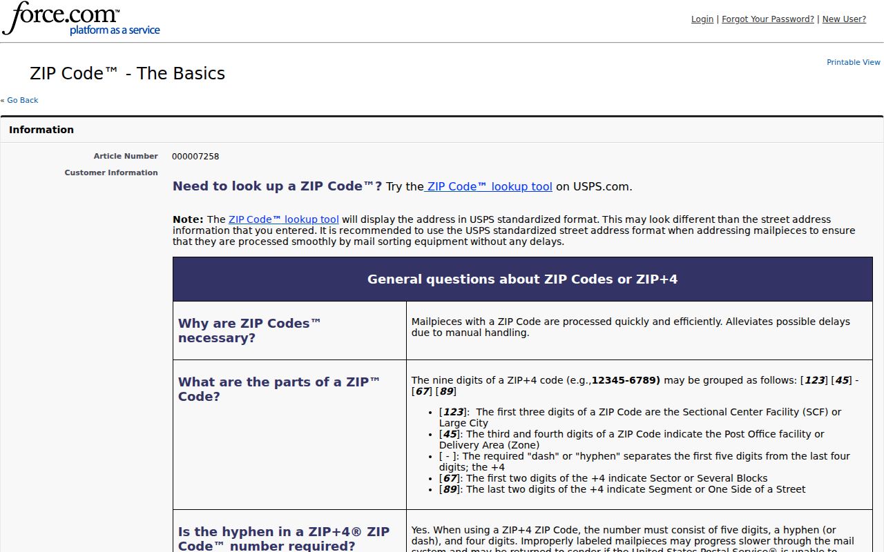
The screen supports the central rule: ZIP boundaries do not follow municipal lines. A valid Louisville last line can still describe a parcel in another local jurisdiction.
Search Louisville Residents by ZIP
No ordinary official portal provides a free, open roster of everyone in one Louisville ZIP code. The PVA accepts an address or parcel ID, not a ZIP-wide people query. LOJIC supports map and address navigation, but the inspected viewer has no ZIP-wide resident search. The Kentucky voter file can be delivered household by ZIP only through the regulated SBE-84 process for qualified requesters and lawful purposes.
- Standardize the full address through USPS and save the ZIP+4 when returned.
- Find the parcel through Jefferson PVA or LOJIC using the street address, not just the ZIP.
- Record the situs address, parcel ID, map location, and the date of the official result.
- Use a lawful record source for the named person. Do not treat a postal area as proof of residence.
Once a ZIP narrows the area, the Louisville street directory explains the street-level parcel and deed route. That next step is more precise than trying to infer a household from postal geography.
Qualified voter-data requesters can choose a county, precinct, district, party block, inactive-record option, and delivery form on SBE-84. Household-by-ZIP is one delivery choice. The requester signs an oath against commercial use, sale, or transfer, and the State Board of Elections describes a seven-to-ten-business-day process. That controlled file route is not permission for a casual ZIP-wide people search.
Louisville ZIP Data Updates
USPS Address Information System products include city/state, delivery type, county retrieval, delivery statistics, ZIP+4, and address lookup. USPS says the data are monthly and cannot be exported from the inspected page. The observed update date was August 17, 2026.
The captured USPS PostalPro page shows the official data-product context behind address validation.
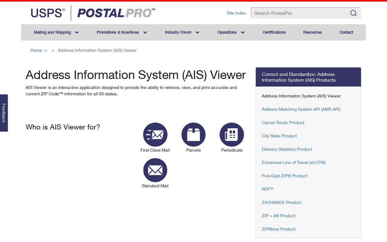
Postal data can change. Date-stamp a Louisville ZIP code directory result, especially when checking a new development, renamed street, suite, or border address.
Reading Louisville Address Numbers
Louisville's address grid adds a useful check. Main Street and Shelbyville Road form north and south zero baselines, while First Street sets the east and west baseline. Blocks generally rise by 100. On east-west streets, north-side numbers are odd and south-side numbers are even. On north-south streets, west-side numbers are even and east-side numbers are odd.
Metro Code also requires unit, apartment, or suite identifiers for multi-unit sites and calls for a USPS-validated ZIP+4 last line. These rules can expose a typo before a parcel search. They do not prove occupancy. Street names can change through the official Street Index File process, and old Louisville numbers may not match the modern postal form.
The Filson Historical Society documents a sharp local example. A household recorded at 1601 South Clay before Louisville's 1909 renumbering appears at 801 South Clay afterward. Searching only the modern number can create a false break. For old resident work, pair both numbers with the surname, legal description, adjacent streets, and a dated directory.
Louisville Parcels Beat ZIP Guesses
A Jefferson PVA parcel ID, such as the compact formats shown in official records, is not a ZIP, deed book and page, apartment number, or legal description. It is the bridge between assessment and GIS systems. Use the PVA address search, then open LOJIC to confirm the mapped parcel and nearby streets. LOJIC warns that its parcel lines are not legal boundaries.
For title or boundary questions, read the Clerk's deed, legal description, and recorded plat. A mailing address may differ from the situs address. Keeping both fields prevents a Louisville postal result from being mistaken for the physical location of the parcel or the current home of an owner.
Louisville ZIPs and City Limits
Louisville record geography is layered. The legal city, consolidated Metro government, Jefferson County offices, separate home-rule cities, USPS last lines, urban neighborhoods, and LOJIC parcels answer different questions. Census figures also vary by geography, so a population number for Louisville city cannot be swapped with one for the Louisville/Jefferson County Metro government balance.
A Louisville ZIP code directory must keep those layers visible. Shively, Anchorage, Middletown, St. Matthews, Prospect, and other local jurisdictions can share Louisville postal treatment. Conversely, outer Metro ZIPs in the 400xx and 401xx ranges can appear on a Jefferson County map without being Louisville city addresses. Check the USPS delivery result, LOJIC parcel, municipal boundary, and legal description separately.
Neighborhood maps add context once the parcel is known. They can distinguish Butchertown from Clifton or Beechmont from Iroquois, but LOJIC's named polygons still do not define mail service. Use the neighborhood label for local history and nearby records. Use USPS for delivery, PVA for assessment, the Clerk for recorded title documents, and the appropriate city or Metro source for legal jurisdiction.
- ZIP versus ZIP+4
- A five-digit delivery area versus a more precise nine-digit delivery segment.
- PO-box ZIP
- A code used for post-office boxes rather than a normal street delivery area.
- Unique ZIP
- A code assigned for one high-volume organization or institution.
- Carrier route
- A postal delivery path within a ZIP, not a resident or legal-boundary list.
Boundary check. Never use a Louisville mailing label alone to decide the city, tax district, neighborhood, or resident status.